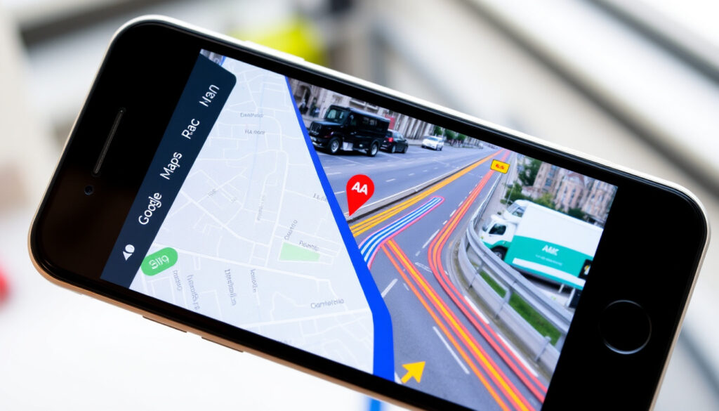
Directions From My Location – Compare Google Maps, RAC & AA
Finding your way from your current location has become an essential part of daily travel planning, whether navigating to a familiar destination or exploring unfamiliar territory. Modern digital tools offer real-time guidance, traffic updates, and precise distance calculations that transform how people move across the United Kingdom. Understanding which services best suit your needs can save time, reduce fuel costs, and help avoid unexpected delays on the road.
Three primary platforms dominate the market for obtaining directions from your current position: Google Maps, the RAC Route Planner, and the AA Route Planner. Each service brings distinct capabilities and limitations that cater to different requirements, from casual everyday navigation to professional fleet management. This guide examines how these tools work, their specific strengths for UK users, and practical steps for getting accurate directions whether you are driving or prefer to travel on foot.
How to Get Driving Directions from My Current Location
Obtaining driving directions from your current location involves using geolocation technology built into smartphones and navigation websites. The process varies slightly between platforms, but the fundamental approach remains consistent across all major services available in the United Kingdom.
Google Maps auto-detects your position via GPS. RAC Route Planner also pinpoints your location automatically. The AA Route Planner requires manual entry of your starting point. Choose based on whether you prefer convenience or control over your starting coordinates.
Key Insights for UK Drivers
- Enable location services on your device before attempting to find directions from your current position
- Google Maps automatically detects your location via device GPS and allows immediate route calculation
- The RAC Route Planner provides built-in mileage calculators that estimate fuel costs and CO2 emissions for business claims
- The AA Route Planner includes landmarks and speed camera information in its step-by-step directions
- Traffic information may appear on separate tabs rather than integrated directly into route planning views
- Offline map downloads work best for rural areas where mobile signal may be limited
| Feature | Google Maps | RAC Route Planner | AA Route Planner |
|---|---|---|---|
| Current Location Detection | Auto via GPS | Auto-pinpoint | Manual entry required |
| Distance Calculator | Shows distance and time | Costs, CO2, business claims | Integrated mileage tool |
| Route Options | Multiple alternatives | Avoid motorways/jams | Landmarks, closures |
| 3D View | Street View | 3D view available | Not specified |
| Traffic Integration | Real-time dynamic avoidance | Live updates | Separate traffic tab |
| Sharing Options | Built-in sharing | Print, email, share | Save and print |
| UK Coverage | Global and UK | Popular for UK/Europe | UK, Ireland, EU |
| Membership Benefits | Free service | Fuel finder, breakdowns | Breakdowns, MOT reminders |
Walking Directions from My Location
Pedestrian navigation requires different considerations than vehicle routing. Walking directions must account for footpaths, pedestrianised areas, and shortcuts that vehicles cannot use. Not all route planning tools offer equal support for pedestrian travel.
Platform-Specific Walking Features
Google Maps provides comprehensive walking support with the ability to download offline maps for areas where mobile data coverage may be unreliable. Users can toggle between driving and walking modes to receive step-by-step pedestrian directions. The platform also includes access to Street View, allowing walkers to preview their route visually before setting off.
The RAC Route Planner offers walking directions through a beta toggle feature, meaning the functionality continues to be refined. This option suits users who occasionally need pedestrian guidance alongside their primary driving needs, though the service emphasises vehicle navigation.
The AA Route Planner focuses predominantly on driving directions. Walking support remains limited compared to dedicated pedestrian applications, making it less suitable for those primarily seeking foot-based travel guidance.
For walking trips in the UK, download offline maps before departing. Rural footpaths and urban pedestrian routes are well-documented on Google Maps, with regular updates reflecting new walking infrastructure across the country.
Best Route Planners: Google Maps, AA, and RAC
Choosing the right route planner depends on your specific requirements, whether that involves the breadth of coverage, membership benefits, or particular features like distance calculations for business purposes. Each service occupies a distinct position in the market.
Google Maps Strengths
Independent testing places Google Maps at the top for accuracy and traffic integration. The platform demonstrated no faults during comprehensive evaluations, delivering reliable directions across varied UK locations. Its free availability, combined with global and UK coverage, makes it the most accessible option for everyday users. The interface supports multiple route alternatives, real-time traffic avoidance, and seamless switching between devices.
RAC Route Planner Advantages
The RAC Route Planner excels for those requiring detailed text-based directions that can be printed, emailed, or shared. Its mileage calculator goes beyond simple distance measurement, incorporating fuel cost estimates, CO2 calculations, and functionality specifically designed for business expense claims. The accompanying mobile app provides fuel price information and live updates, adding value for regular drivers who may need breakdown assistance through membership.
AA Route Planner Features
The AA Route Planner provides straightforward UK, Ireland, and EU planning with routes that include landmarks, road closures, and speed camera information. While the interface appears more basic compared to competitors, the emphasis on reliable landmarks proves valuable for drivers unfamiliar with their route. Membership subscribers gain access to breakdown services and MOT reminders, integrating navigation with broader vehicle management.
Other Notable Options
Green Flag offers similar UK and Europe driving coverage with waypoint support, though pedestrian features receive less emphasis. TomTom Routes and Waze demonstrate strong traffic capabilities but ranked below Google Maps in UK-based testing. These alternatives merit consideration for users with specific needs not fully addressed by the three primary platforms.
Step-by-Step Directions and Distance Tools
Beyond basic navigation, modern route planners offer tools for measuring distances, calculating travel costs, and planning multi-stop journeys. Understanding these capabilities helps users select the most appropriate service for their circumstances.
Using Distance Calculators
All three major platforms provide mileage information as part of their standard directions output. Google Maps displays distance and estimated travel time alongside route alternatives. The RAC Route Planner expands this functionality to include cost estimates based on vehicle efficiency and current fuel prices, along with CO2 emissions data suitable for environmental reporting or business claims.
The AA Route Planner incorporates an integrated mileage calculator within its route planning interface, allowing users to determine distances without requiring separate tools. This proves particularly useful for fleet operators and self-employed drivers tracking business mileage for tax purposes.
For professional mileage documentation, the RAC Route Planner offers the most comprehensive built-in solution, combining distance measurement with cost calculations and CO2 estimates designed specifically for expense claims and environmental reporting.
Getting Directions from Your Current Location
The specific steps for obtaining directions vary by platform. Google Maps users open the application or website and allow geolocation access; the service automatically detects your position and presents the Directions icon for route planning. RAC Route Planner similarly auto-pinpoints your location upon visiting the website, eliminating the need to manually enter starting coordinates. The AA Route Planner requires users to input their starting position manually, which some users prefer for greater precision over automated detection.
The Evolution of Digital Route Planning
Route planning tools have undergone significant transformation since their introduction, evolving from basic point-to-point calculators to sophisticated platforms integrating real-time traffic, alternative routes, and multimodal transportation options.
- Early online map services provided static route calculations without real-time data or mobile integration
- GPS navigation devices introduced in-car turn-by-turn guidance independent of internet connectivity
- Smartphone applications combined location services with internet-connected mapping for dynamic updates
- Google Maps established new standards for real-time traffic integration and cross-platform synchronisation
- Automobile association planners expanded to include membership benefits beyond navigation, including breakdown services
- Current platforms now incorporate environmental calculations, business expense tools, and offline capabilities for areas with limited connectivity
What We Know for Certain About Route Planning
Understanding which information is established fact versus variable data helps users set appropriate expectations when using navigation services.
| Established Information | Variable Information |
|---|---|
| Google Maps offers free, globally available directions with real-time traffic integration | Actual traffic conditions at any given moment depend on local circumstances |
| RAC and AA Route Planners include mileage calculators for cost and emissions estimates | Fuel price calculations vary based on vehicle efficiency assumptions and current prices |
| Google Maps auto-detects location via device GPS without manual entry | GPS accuracy depends on device hardware and environmental factors |
| AA Route Planner requires manual start location entry | Offline map availability and update frequency vary by region |
| RAC Route Planner supports waypoints for multi-stop journeys | Some features like RAC walking mode remain in beta development |
Why Reliable Directions Matter in the UK
Accurate navigation serves practical purposes beyond simple convenience. For drivers navigating urban areas with Clean Air Zones, knowing your intended route helps anticipate any charges or restrictions that may apply. Planning ahead for airport transfers or understanding road closures ahead of departure reduces stress and potential delays.
Professional drivers, delivery personnel, and anyone tracking business mileage benefit from tools that automatically record distances for documentation purposes. The ability to share routes with colleagues or family members adds safety considerations, allowing others to monitor your progress on longer journeys.
For visitors to the United Kingdom or those exploring unfamiliar regions, reliable directions prove especially valuable. The combination of left-hand driving, varied road types from motorways to narrow country lanes, and region-specific signage makes accurate navigation particularly important for safe travel. Those planning routes through cities with environmental restrictions may find it helpful to check Clean Air Zone requirements before departing to avoid unexpected charges.
What Sources Say About Modern Route Planners
Independent reviews and automotive publications have evaluated route planning tools specifically for UK users, providing benchmarks against which these services can be assessed.
Google Maps wins for accuracy and traffic management, with no faults identified during testing. The platform delivers consistent results across global and UK coverage areas.
— Automotive Express route planner testing
RAC Route Planner offers excellent text-based directions suitable for printing and sharing, with traffic news integration proving popular among UK and European users.
— Holiday Extras travel advice
For those with automobile association memberships, dedicated route planners provide additional benefits beyond navigation, including breakdown assistance and vehicle management tools.
— Autoweb route planner comparisons
Summary: Finding Directions from Your Location
Getting directions from your current location in the UK requires choosing a tool that matches your specific needs. Google Maps offers the most accessible and accurate option for general use, while RAC Route Planner provides additional features for professional drivers and business users. The AA Route Planner suits members seeking integrated breakdown services alongside navigation. For those planning routes through urban areas with environmental restrictions, such as the Birmingham Clean Air Zone, checking your intended route in advance helps avoid unexpected charges. Whether driving or walking, enabling location services and downloading offline maps for rural areas ensures the most reliable guidance regardless of connectivity.
Frequently Asked Questions
How do I get travel directions by car map?
Open Google Maps or your preferred route planner, allow location access, enter your destination, and select the driving mode. The platform will calculate and display your route with estimated distance and travel time.
Can I calculate distance on a map?
Yes, all major route planners display distance as part of their standard output. RAC and AA Route Planners include additional mileage calculators for costs and CO2 estimates.
How do I set directions to home?
Most mapping apps allow you to save your home address in your profile. Once saved, you can quickly select it as a destination from the app’s home screen without re-entering details.
Are these route planners available across the UK?
Google Maps provides global and UK coverage. RAC and AA Route Planners offer strong UK, Ireland, and European coverage, with particular emphasis on British road networks.
Can I find coordinates using Google Maps?
Yes, you can view latitude and longitude coordinates for any location by right-clicking on a point in Google Maps and selecting the coordinates option. This works on both desktop and mobile applications.
Do I need mobile data for directions?
Google Maps supports offline map downloads for areas where connectivity may be limited. Download maps before your journey for reliable navigation without data access.
Which route planner works best for business mileage?
The RAC Route Planner includes purpose-built mileage calculators for business expense claims, including cost estimates and CO2 emissions data suitable for environmental reporting.
More related posts
 Blue Peter: BBC Presenters, Badge Scandal & History
 Rick Moranis: Why He Quit Acting and His Return
 Are Pandora Rings Good Quality? Price, Gold & Durability
 Kristen Wiig: Biography, Movies, Husband, Children & Net Worth
 David Earl: After Life Actor & Chatabix Host | Bio
 Star Wars A New Hope – Cast, Plot Summary, 1977 Release
 Fionn O’Shea: Actor, Sports Scientist, and Dual Career
 John Cusack: Career, Net Worth & What Happened to Him