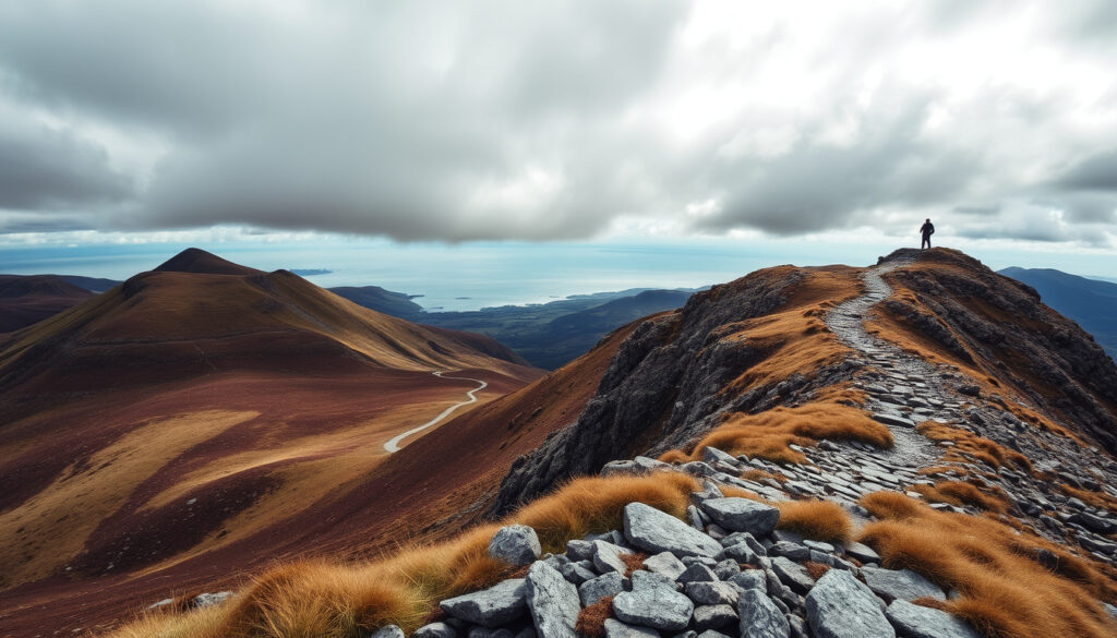
Slieve Donard Hike: Guide to Northern Ireland’s Highest Peak
Most hikers underestimate the final push up Slieve Donard — but with the right preparation, Northern Ireland’s highest peak is an achievable and rewarding climb. This guide covers the key routes, difficulty, duration, and safety tips so you can plan with confidence.
Height & Rank
- 850 m (2,790 ft) — Mountain Ways Ireland
- Highest in Northern Ireland
- Seventh-highest in Ireland
Difficulty
- Moderate — Wild Irish Walks
- Steep final section
- Suitable for regular walkers
Typical Duration
- 4–6 hours round trip — The Irish Road Trip
- Varies by route and pace
Start Point
- Donard Park, Newcastle — Mud and Routes
- Free parking available
Height: 850 metres (2,790 feet) | Rank: Highest mountain in Northern Ireland and Ulster | Typical hike time: 4–6 hours round trip | Distance (Glen River route): Approx. 8 km (5 miles) return | Difficulty: Moderate; steep in sections | Start point: Donard Park, Newcastle
| Label | Value |
|---|---|
| Elevation | 850 m (2,790 ft) |
| Location | Newcastle, County Down, Northern Ireland |
| Range | Mourne Mountains |
| Nearest town | Newcastle (0.5 mi from trailhead) |
| Most popular route | Glen River from Donard Park (8 km return) |
| Public transport | Frequent bus service from Belfast to Newcastle |
| OS Grid Reference | J 358 277 |
How long does it take to walk up Slieve Donard?
What is the typical round-trip time?
The standard Glen River route from Donard Park to the summit and back is usually completed in 4 to 6 hours, depending on fitness and conditions. The Irish Road Trip notes the average falls within that window, while Mountain Ways Ireland reports that guided groups often take 5 to 6 hours due to group pace and weather stops.
How does the chosen route affect duration?
The quickest ascent is the Glen River route — called “the shortest and quickest ascent from Newcastle” by Mountaintrails.ie. Alternative routes, like the Bloody Bridge or Trassey Track, add distance and time but offer different scenery. Most hikers stick to the Newcastle start for efficiency.
What factors can slow down the hike?
Weather is the biggest wildcard: high winds, rain, or low cloud can add an hour or more. Group size, frequent photo stops, and unfamiliarity with the terrain also extend the clock. Wild Irish Walks stresses that the final steep section near the summit can double the effort per kilometre.
“Always allow extra time for the descent — your legs will be tired, and the loose stone near the top requires care.”
— Mountain guide, Mountain Ways Ireland
Bottom line: Plan for 5 hours as a realistic midpoint; add a buffer for weather and breaks. A faster hiker may finish in 4, but rushing increases risk.
Is Slieve Donard hard?
What makes the climb challenging?
Multiple sources grade the Newcastle route as difficult or hard. Wild Irish Walks calls the entire outing “difficult”, Mud and Routes describes it as “a hard walk”, and AllTrails says it’s “hard and suitable for experienced hikers with high fitness levels”. The steepest section is the final pull from the col beside The Saddle to the summit — Wild Irish Walks describes it as simply “steep”.
How does it compare to other Mourne Mountains?
Among the Mournes, Slieve Donard is the highest but not the most technical. Mountaintrails.ie labels a combined Slieve Donard and Slieve Commedagh circuit “strenuous”, so the solo ascent is a step down in endurance demand. Compared to lower peaks like Slieve Bearnagh, Donard’s gradient is more sustained but less rocky in the upper section.
What fitness level is recommended?
Regular walkers with good aerobic fitness will manage comfortably. An average of 4–5 hours of hill walking per week is enough preparation. The 853 m of height gain — measured by Mountain Ways Ireland over a 9 km out-and-back — requires decent leg strength for the ascent and knee stability for the descent.
Safety note: The steep final slope is exposed. In wet or windy conditions, slipping is the main hazard. Trekking poles and sturdy boots are strongly recommended.
Implication: Donard is moderate overall but the summit push is legitimately hard — treat it as a strenuous day out, not a casual stroll.
What town is Slieve Donard in?
Where is the nearest town?
Slieve Donard rises directly behind the seaside town of Newcastle, County Down. The trailhead at Donard Park is less than a mile from the town centre. Mud and Routes confirms the route begins in Donard Park and follows the Glen River through Donard Wood.
How far is it from Belfast?
Newcastle is roughly 30 miles (48 km) south of Belfast — about a 40-minute drive via the A24. Regular bus services (Translink Goldline) run from Belfast’s Europa Buscentre to Newcastle, making a day trip possible without a car.
What are the parking options?
Donard Park offers free parking, though it can fill by mid-morning on weekends and bank holidays. Overflow parking is available in Newcastle town centre (pay-and-display). The park is also the start point for the Glen River ascent; Mountain Ways Ireland notes that the climb begins at sea level, giving you 850 m of vertical gain from the car park.
“The Mourne Wall is a remarkable feat of dry stone construction that defines the character of the upper mountain.”
— Mourne Heritage Trust representative, Visit Mourne Gullion Strangford
Why is there a wall on Slieve Donard?
What is the Mourne Wall?
The Mourne Wall is a 22-mile (35 km) dry stone wall built between 1904 and 1922 by the Belfast Water Commissioners. It encloses a water catchment area that supplies Belfast’s reservoirs. Visit Mourne Gullion Strangford explains that it “follows the high ground across the Mourne Mountains” and is described as strenuous.
Who built it and why?
The wall was constructed to prevent livestock from contaminating the water supply. Built using traditional dry stone walling techniques, it traverses the summits of 15 mountains, including Slieve Donard. The final section of the hike from The Saddle to the summit runs right alongside the wall — Mud and Routes confirms that “the final section climbs along the Mourne Wall to the summit”.
Does the wall follow a specific route?
Yes, the wall acts as a giant boundary marker across the high ridges. On Slieve Donard’s upper slopes it is “visible and prominent”, according to Visit Mourne Gullion Strangford. Hikers often use it as a navigation aid in poor visibility — a rare safety bonus from a century-old infrastructure project.
| Period | Event |
|---|---|
| 1904–1922 | Construction of the Mourne Wall by Belfast Water Commissioners |
| 1930s–1940s | Slieve Donard becomes popular walking destination; first guidebooks published |
| 1966 | Designation as part of Mourne Area of Outstanding Natural Beauty |
| 2000s | Trail maintenance and signage improvements by Mourne Heritage Trust |
Pro tip: Use the Mourne Wall as a handrail in fog. Its unbroken line from The Saddle to the summit keeps you on track even when visibility drops to a few metres.
What is the height of Slieve Donard?
How tall is Slieve Donard in metres and feet?
The summit stands at 850 metres (2,790 feet) above sea level. Mountain Ways Ireland lists this elevation, and the same figure appears across all major outdoor sites. Because the Newcastle start is at sea level, the total elevation gain on that route is essentially the same as the summit height.
How does it rank among Irish mountains?
Slieve Donard is the highest mountain in Northern Ireland and in the province of Ulster. It ranks as the seventh-highest peak in all of Ireland, behind the MacGillycuddy’s Reeks and other 900 m-plus peaks in the southwest. Its prominence (about 822 m) makes it a Marilyn — a hill with 150 m of drop on all sides.
What is the prominence?
The prominence of 822 m means it’s the highest point for a large area, with no higher land within a long radius. That gives it extensive views: on a clear day you can see the Isle of Man, the Scottish coast, and the whole length of the Mourne coastline.
What this means: At 850 m, Donard is tall enough for a serious workout but not so high that altitude becomes a factor — the only barrier is weather and your own legs.
Confirmed facts
- Slieve Donard is the highest mountain in Northern Ireland at 850 m — Mountain Ways Ireland
- The Mourne Wall was built to enclose a water catchment area — Visit Mourne Gullion Strangford
- Donard Park is the main starting point — Mud and Routes
What’s unclear
- Exact number of daily hikers (varies seasonally)
- Historical naming origin of “Slieve Donard” (several theories)
walkhighlands.co.uk, theirishroadtrip.com, mudandroutes.com, facebook.com, alltrails.com, tripadvisor.com, mountainwaysireland.com, facebook.com, xn--ddkyb8bu907ak6u.com
For a detailed walkthrough of routes and difficulty, you can refer to this guide to Slieve Donard hike that also covers the hotel sale.
Frequently Asked Questions
Can you climb Slieve Donard in winter?
Yes, but only with proper gear: crampons, ice axe, and navigational skills. The Mourne Wall route is prone to ice, and winds can exceed 80 km/h. Most guided groups operate only from April to October.
Are dogs allowed on Slieve Donard?
Yes, but keep them on a lead near livestock and on the steep upper section. The terrain is tough on paws — consider booties for rocky sections.
Do you need a permit to hike Slieve Donard?
No permit is required. Access is free and open year-round, though the Mourne Heritage Trust asks walkers to follow the Leave No Trace principles.
What is the steepest part of the climb?
The final 300 metres from The Saddle to the summit, where the gradient exceeds 30° in places. Wild Irish Walks calls this section “steep”.
Is there phone signal on the mountain?
Signal is intermittent. The lower Glen River valley has good 4G, but the upper slopes and summit often lose reception. Download offline maps before you start.
How do I get to Donard Park by public transport?
Translink Goldline service 923 from Belfast to Newcastle runs hourly. Alight at the Newcastle bus station; Donard Park is a 15-minute walk along the seafront.
More related posts
 Liam Neeson and Pamela Anderson: Romance Rumors Explained
 Paula Patton: Ethnicity, Divorce, and Life in 2024
 Nikki Bella: Custody, Children, and Relationship Updates
 Romilly Weeks: Biography, Career, Family and More
 Faith Evans: Biography, Children, and Biggie Relationship
 Jeremy Renner: Accident, Recovery, and Controversy
 Bank Holidays 2024 UK – Complete Regional Lists
 Lil Tecca: Biography, Fame, Net Worth, and Career Facts